Geolocate

Felton topographic map

Click on the map to display elevation.

About this map
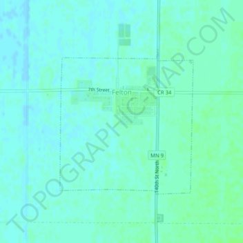
Name: Felton topographic map, elevation, terrain.

Location: Felton, Clay County, Minnesota, United States (47.06720 -96.51647 47.08335 -96.49470)

Average elevation: 279 m

Minimum elevation: 276 m

Maximum elevation: 283 m

Other topographic maps

Click on a map to view its topography, its elevation and its terrain.

Finkle

United States > Minnesota > Clay County

Average elevation: 278 m

Ruthruff

United States > Minnesota > Clay County

Average elevation: 279 m

Gear up for your next adventure:

🥾Durable Hiking Shoes - Long-lasting shoes for frequent hiking
🧦Hiking Liner Socks - Thin base layer to prevent friction and blisters
🎒Fully Waterproof Backpack - Total protection for photography gear and electronics
🧶550 Survival Paracord - Versatile utility cord for emergency repairs and rigging
🧊Insulated Water Bottle - Keeps drinks cold in summer and prevents freezing in winter

As an Amazon Associate, this site earns from qualifying purchases at no extra cost to you.