Geolocate

Tartus topographic map

Click on the map to display elevation.

About this map
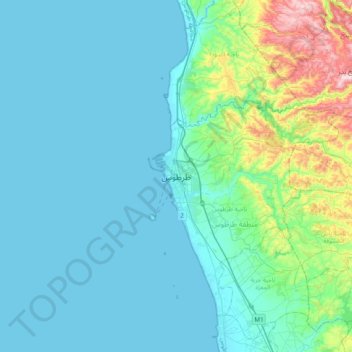
Name: Tartus topographic map, elevation, terrain.

Location: Tartus, Tartus Subdistrict, Tartus District, Tartus Governorate, Syria (34.73362 35.72517 35.05362 36.04517)

Average elevation: 91 m

Minimum elevation: 0 m

Maximum elevation: 633 m

Other topographic maps

Click on a map to view its topography, its elevation and its terrain.

Jazirat Al-Abbas

Syria > Tartus Governorate > Tartus

Average elevation: 0 m

Gear up for your next adventure:

🗺️Topographic Maps - Detailed maps to explore trails, mountains, and wilderness areas
🚲Heavy Duty Bike Lock - Secure your bike at the trailhead or during stops
🔥Camping Stove - Portable stoves to cook outdoors with ease
💧Filtered Water Bottle - Safe drinking water on the go
🩹Moleskin Blister Pads - Direct protection for painful foot pressure points

As an Amazon Associate, this site earns from qualifying purchases at no extra cost to you.