Geolocate

Tella topographic map

Click on the map to display elevation.

About this map
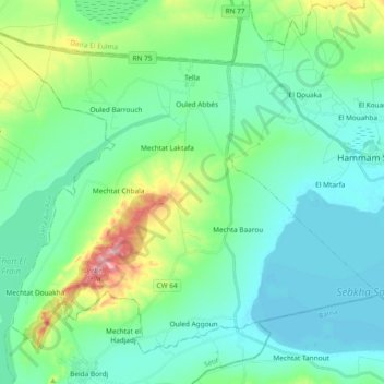
Name: Tella topographic map, elevation, terrain.

Location: Tella, Hammam Sokhna District, Setif, 19000, Algeria (35.89954 5.62264 36.02650 5.80965)

Average elevation: 911 m

Minimum elevation: 872 m

Maximum elevation: 1,053 m

Other topographic maps

Click on a map to view its topography, its elevation and its terrain.

Sebkha Sokhna

Algeria > Setif > Hammam Sokhna District > Tella

Average elevation: 890 m

Gear up for your next adventure:

🧦Hiking Socks - Moisture-wicking and comfortable socks for long hikes
💧Filtered Water Bottle - Safe drinking water on the go
🎒Backpack Rain Cover - External shield to keep your entire pack dry
🥾Light Hiking Boots - Lightweight and comfortable boots for day hikes
🔦LED Headlamp - Hands-free lighting for early morning starts or late finishes

As an Amazon Associate, this site earns from qualifying purchases at no extra cost to you.