Geolocate

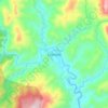
Apayao River topographic map

Click on the map to display elevation.

About this map

Name: Apayao River topographic map, elevation, terrain.

Location: Apayao River, Apayao, Cordillera Administrative Region, Philippines (18.01742 121.00432 18.25918 121.36364)

Average elevation: 614 m

Minimum elevation: 40 m

Maximum elevation: 2,234 m

Other topographic maps

Click on a map to view its topography, its elevation and its terrain.

Flora

Philippines > Apayao

Average elevation: 32 m

Luna

Philippines > Apayao

Average elevation: 71 m

Calanasan

Philippines > Apayao

The town's topography or slope is predominantly rugged and mountainous with sporadic flood plains and plateaus. The municipality cradles the larger part of the Apayao-Abulog watershed area as the main source of streams that fills the mighty river which originates from the municipality.

Average elevation: 524 m

Kabugao

Philippines > Apayao

Average elevation: 245 m

Quirino

Philippines > Apayao

Average elevation: 14 m

Nagbabalayan

Philippines > Apayao

Average elevation: 196 m

San Mariano

Philippines > Apayao

Average elevation: 14 m

Santa Marcela

Philippines > Apayao

Average elevation: 13 m

Pudtol

Philippines > Apayao

Average elevation: 32 m

Aurora

Philippines > Apayao

Average elevation: 83 m

Guina-ang

Philippines > Apayao > Guina-ang

Average elevation: 266 m

Tanglagan

Philippines > Apayao > Tanglagan

Average elevation: 618 m

Sabangan

Philippines > Apayao > Calanasan

Average elevation: 438 m

Buluan

Philippines > Apayao > Conner

Average elevation: 168 m

Taracay

Philippines > Apayao > Lenneng

Average elevation: 350 m

Quirino

Philippines > Apayao > Luna

Average elevation: 14 m

Tanglagan

Philippines > Apayao > Calanasan

Average elevation: 619 m

San Isidro Sur

Philippines > Apayao > Luna

Average elevation: 17 m

Daga

Philippines > Apayao > Conner

Average elevation: 162 m

Bulu

Philippines > Apayao > Kabugao

Average elevation: 260 m

Bulu

Philippines > Apayao > Kabugao

Average elevation: 260 m

Flora

Philippines > Apayao

Average elevation: 32 m

Kabugao

Philippines > Apayao

Average elevation: 245 m

Buluan

Philippines > Apayao > Conner

Average elevation: 168 m

Calanasan

Philippines > Apayao

The town's topography or slope is predominantly rugged and mountainous with sporadic flood plains and plateaus. The municipality cradles the larger part of the Apayao-Abulog watershed area as the main source of streams that fills the mighty river which originates from the municipality.

Average elevation: 524 m

Luna

Philippines > Apayao

Average elevation: 34 m

Gear up for your next adventure:

⛺Backpacking Tent - Lightweight tent for long-distance hiking trips
🥾Trail Hiking Boots - Supportive boots for rough trails
🦶Anti-Blister Balm - Prevents friction and hotspots during long ascents
🪑Ultralight Camping Stool - Compact seating for rest stops during long hikes
🥾Mountain Hiking Shoes - Shoes with superior grip for mountainous terrain

As an Amazon Associate, this site earns from qualifying purchases at no extra cost to you.