Geolocate

Arica topographic map

Click on the map to display elevation.

About this map

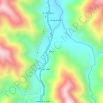
Name: Arica topographic map, elevation, terrain.

Location: Arica, San Gabán, Province of Carabaya, Puno, Peru (-13.52691 -70.44049 -13.48691 -70.40049)

Average elevation: 1,032 m

Minimum elevation: 687 m

Maximum elevation: 1,595 m

Gear up for your next adventure:

🕶️Polarized Sunglasses - Protect your eyes with durable polarized lenses
🦶Anti-Blister Balm - Prevents friction and hotspots during long ascents
💡LED Camping Lantern - Illuminate your campsite with long-lasting lanterns
👟Trail Running Shoes - Agile footwear for fast-paced topographic exploration
🎒Hiking Daypack - Lightweight and durable backpacks for day trips and excursions

As an Amazon Associate, this site earns from qualifying purchases at no extra cost to you.