
Make a donation
Gear up for your next adventure:
As an Amazon Associate, this site earns from qualifying purchases at no extra cost to you.
Maxwell topographic map
Click on the map to display elevation.
Make a donation
Gear up for your next adventure:
As an Amazon Associate, this site earns from qualifying purchases at no extra cost to you.
About this map
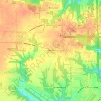
Name: Maxwell topographic map, elevation, terrain.
Location: Maxwell, Peoria County, Illinois, United States (40.66865 -89.72038 40.70865 -89.68038)
Average elevation: 207 m
Minimum elevation: 177 m
Maximum elevation: 222 m
Make a donation
Gear up for your next adventure:
As an Amazon Associate, this site earns from qualifying purchases at no extra cost to you.
Other topographic maps
Click on a map to view its topography, its elevation and its terrain.
Peoria Heights
United States > Illinois > Peoria County
Topographically, the village can be roughly divided into three zones. The Illinois River floodplain, the bluff, and the plateau. While its eastern border is fairly regular with the river's edge, the rest of its municipal border, with Peoria, is quite irregular and convoluted.
Average elevation: 183 m
Make a donation
Gear up for your next adventure:
As an Amazon Associate, this site earns from qualifying purchases at no extra cost to you.
Make a donation
Gear up for your next adventure:
As an Amazon Associate, this site earns from qualifying purchases at no extra cost to you.