
Thank you for supporting this site ❤️
Make a donation
Make a donation
Gear up for your next adventure:
As an Amazon Associate, this site earns from qualifying purchases at no extra cost to you.
Herrenberg topographic map
Click on the map to display elevation.
Thank you for supporting this site ❤️
Make a donation
Make a donation
Gear up for your next adventure:
As an Amazon Associate, this site earns from qualifying purchases at no extra cost to you.
About this map
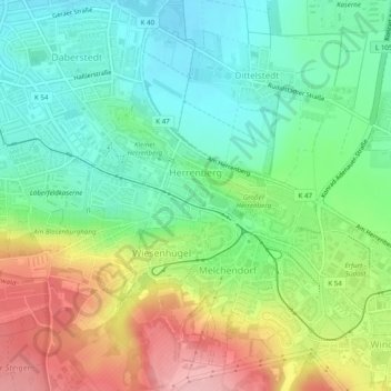
Name: Herrenberg topographic map, elevation, terrain.
Location: Herrenberg, Dittelstedt, Erfurt, Thüringen, Deutschland (50.94700 11.05247 50.96489 11.10107)
Average elevation: 258 m
Minimum elevation: 202 m
Maximum elevation: 352 m
Thank you for supporting this site ❤️
Make a donation
Make a donation
Gear up for your next adventure:
As an Amazon Associate, this site earns from qualifying purchases at no extra cost to you.