Geolocate

Petersburg topographic map

Click on the map to display elevation.

About this map

Name: Petersburg topographic map, elevation, terrain.

Location: Petersburg, Grant County, West Virginia, 26847, United States (38.97829 -79.15043 39.00698 -79.11143)

Average elevation: 302 m

Minimum elevation: 273 m

Maximum elevation: 476 m

Other topographic maps

Click on a map to view its topography, its elevation and its terrain.
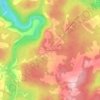
Mount Storm

United States > West Virginia > Grant County

Average elevation: 834 m

Gear up for your next adventure:

⛺Lightweight Camping Tent - Portable shelter optimized for Canadian backcountry camping
🔦LED Headtorch - Bright and durable light for night activities
🧢Hiking Sun Hat - Wide-brimmed protection for exposed mountain ridges
🩹Moleskin Blister Pads - Direct protection for painful foot pressure points
🏃Hydration Running Vest - Carry water and maps close to your body for speed

As an Amazon Associate, this site earns from qualifying purchases at no extra cost to you.