
Make a donation
Gear up for your next adventure:
As an Amazon Associate, this site earns from qualifying purchases at no extra cost to you.
Altendorf topographic map
Click on the map to display elevation.
Make a donation
Gear up for your next adventure:
As an Amazon Associate, this site earns from qualifying purchases at no extra cost to you.
About this map
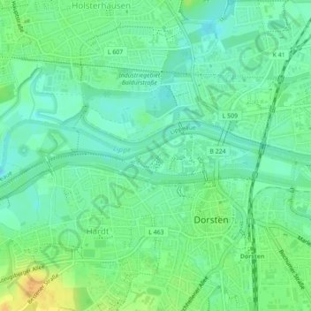
Name: Altendorf topographic map, elevation, terrain.
Average elevation: 34 m
Minimum elevation: 23 m
Maximum elevation: 51 m
Make a donation
Gear up for your next adventure:
As an Amazon Associate, this site earns from qualifying purchases at no extra cost to you.
Other topographic maps
Click on a map to view its topography, its elevation and its terrain.
Make a donation
Gear up for your next adventure:
As an Amazon Associate, this site earns from qualifying purchases at no extra cost to you.
46286
Deutschland > Nordrhein-Westfalen > Kreis Recklinghausen > Dorsten > Lembeck
Average elevation: 60 m
Altendorf-Ulfkotte
Deutschland > Nordrhein-Westfalen > Kreis Recklinghausen > Dorsten
Average elevation: 43 m
Make a donation
Gear up for your next adventure:
As an Amazon Associate, this site earns from qualifying purchases at no extra cost to you.