Geolocate

Sakai topographic map

Click on the map to display elevation.

About this map

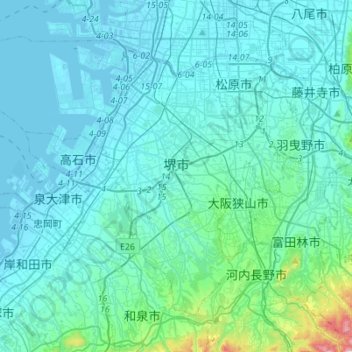
Name: Sakai topographic map, elevation, terrain.

Location: Sakai, Osaka Prefecture, 540-8570, Japan (34.43015 135.31163 34.61105 135.58764)

Average elevation: 60 m

Minimum elevation: -7 m

Maximum elevation: 666 m

Gear up for your next adventure:

🥫Freeze-Dried Meals - Lightweight, high-calorie nutrition for multi-day treks
🧦Outdoor Socks - Durable socks designed for hiking and outdoor sports
🧭GPS Outdoor Watch - Smart watch for navigation and fitness tracking in nature
🧤Rechargeable Heated Gloves - Extreme warmth for Canadian winter expeditions
🥾Mountain Hiking Shoes - Shoes with superior grip for mountainous terrain

As an Amazon Associate, this site earns from qualifying purchases at no extra cost to you.