
Thank you for supporting this site ❤️
Make a donation
Make a donation
Gear up for your next adventure:
As an Amazon Associate, this site earns from qualifying purchases at no extra cost to you.
Ghuttu topographic map
Click on the map to display elevation.
Thank you for supporting this site ❤️
Make a donation
Make a donation
Gear up for your next adventure:
As an Amazon Associate, this site earns from qualifying purchases at no extra cost to you.
About this map
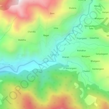
Name: Ghuttu topographic map, elevation, terrain.
Location: Ghuttu, Ghansali, Tehri Garhwal District, Uttarakhand, India (30.50890 78.77015 30.54890 78.81015)
Average elevation: 1,856 m
Minimum elevation: 1,437 m
Maximum elevation: 2,542 m
Thank you for supporting this site ❤️
Make a donation
Make a donation
Gear up for your next adventure:
As an Amazon Associate, this site earns from qualifying purchases at no extra cost to you.