
Make a donation
Gear up for your next adventure:
As an Amazon Associate, this site earns from qualifying purchases at no extra cost to you.
Bruçó topographic map
Click on the map to display elevation.
Make a donation
Gear up for your next adventure:
As an Amazon Associate, this site earns from qualifying purchases at no extra cost to you.
About this map
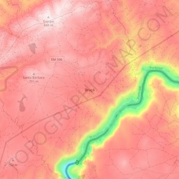
Name: Bruçó topographic map, elevation, terrain.
Location: Bruçó, Mogadouro, Distrito de Bragança, Portugal (41.20503 -6.73698 41.27617 -6.64828)
Average elevation: 664 m
Minimum elevation: 208 m
Maximum elevation: 840 m
Make a donation
Gear up for your next adventure:
As an Amazon Associate, this site earns from qualifying purchases at no extra cost to you.
Other topographic maps
Click on a map to view its topography, its elevation and its terrain.
Make a donation
Gear up for your next adventure:
As an Amazon Associate, this site earns from qualifying purchases at no extra cost to you.
Quinta das Quebradas
Portugal > Distrito de Bragança > Mogadouro > Castelo Branco
Average elevation: 550 m