
43420 topographic map
Click on the map to display elevation.
About this map
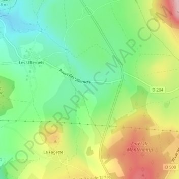
Name: 43420 topographic map, elevation, terrain.
Average elevation: 1,188 m
Minimum elevation: 1,103 m
Maximum elevation: 1,314 m
Other topographic maps
Click on a map to view its topography, its elevation and its terrain.
Les Uffernets
France > Auvergne-Rhône-Alpes > Haute-Loire > Saint-Paul-de-Tartas
Average elevation: 1,158 m
La Fagette
France > Auvergne-Rhône-Alpes > Haute-Loire > Saint-Paul-de-Tartas
Average elevation: 1,149 m
Chaussadis
France > Auvergne-Rhône-Alpes > Haute-Loire > Saint-Paul-de-Tartas
Average elevation: 1,125 m