Geolocate

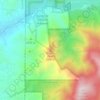
Chimayo topographic map

Click on the map to display elevation.

About this map

Name: Chimayo topographic map, elevation, terrain.

Location: Chimayo, Santa Fe County, New Mexico, 87522, United States (35.97826 -105.98089 36.01796 -105.89746)

Average elevation: 1,907 m

Minimum elevation: 1,787 m

Maximum elevation: 2,149 m

Other topographic maps

Click on a map to view its topography, its elevation and its terrain.
San Pedro

United States > New Mexico > Santa Fe County

Average elevation: 2,165 m

Seton Village

United States > New Mexico > Santa Fe County

Average elevation: 2,140 m

Stanley

United States > New Mexico > Santa Fe County

Average elevation: 1,928 m

Tesuque Pueblo

United States > New Mexico > Santa Fe County

Average elevation: 1,971 m

Picacho Peak

United States > New Mexico > Santa Fe County

Average elevation: 2,409 m

La Loma

United States > New Mexico > Santa Fe County

Average elevation: 2,163 m

Briggs Place

United States > New Mexico > Santa Fe County

Average elevation: 1,999 m

Gear up for your next adventure:

🧢Sun Hat - Wide-brim hat for sun protection
🚲Heavy Duty Bike Lock - Secure your bike at the trailhead or during stops
🧊Portable Cooler - Keep food and drinks cold during outdoor adventures
🔥Emergency Fire Starter - Reliable ignition source for all weather conditions
💧Filtered Water Bottle - Safe drinking water on the go

As an Amazon Associate, this site earns from qualifying purchases at no extra cost to you.