Geolocate

Wakro topographic map

Click on the map to display elevation.

About this map
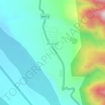
Name: Wakro topographic map, elevation, terrain.

Location: Wakro, Wakro Circle, Lohit district, Arunachal Pradesh, India (27.77121 96.34408 27.78625 96.35475)

Average elevation: 466 m

Minimum elevation: 324 m

Maximum elevation: 917 m

Gear up for your next adventure:

🔦LED Headlamp - Hands-free lighting for early morning starts or late finishes
🔥Camping Stove - Portable stoves to cook outdoors with ease
🔭Compact Monocular - One-handed bird watching and trail spotting
🦶Hiking Shoe Insoles - Added support for high arches and long days on feet
🦌Outdoor Trail Camera - Monitor wildlife activity near your favorite spots

As an Amazon Associate, this site earns from qualifying purchases at no extra cost to you.