Geolocate

Montclair topographic map

Click on the map to display elevation.

About this map

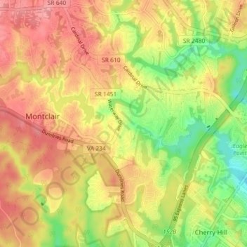
Name: Montclair topographic map, elevation, terrain.

Location: Montclair, Prince William County, Virginia, United States (38.58028 -77.37437 38.63601 -77.30361)

Average elevation: 61 m

Minimum elevation: 4 m

Maximum elevation: 104 m

Gear up for your next adventure:

🧥Softshell Jacket - Windproof and breathable jacket for hiking
🧣Evaporative Cooling Towel - Beat the heat during intense summer climbs
Lightweight Backpacking Tent - Compact tent for efficient hiking trips
🧭Orienteering Kit - Tools for map reading and navigation in the wild
🎒Backpack Rain Cover - External shield to keep your entire pack dry

As an Amazon Associate, this site earns from qualifying purchases at no extra cost to you.