Geolocate

Las Brisas topographic map

Click on the map to display elevation.

About this map

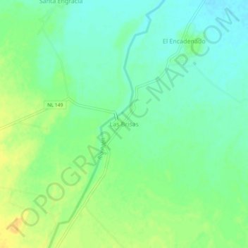
Name: Las Brisas topographic map, elevation, terrain.

Location: Las Brisas, General Terán, Nuevo León, Mexico (25.37411 -99.56668 25.41411 -99.52668)

Average elevation: 227 m

Minimum elevation: 216 m

Maximum elevation: 241 m

Gear up for your next adventure:

👟Trail Running Shoes - Agile footwear for fast-paced topographic exploration
🔦LED Headtorch - Bright and durable light for night activities
🔋Emergency Crank Radio - Weather alerts and power without needing batteries
🌡️Emergency Mylar Blankets - Compact thermal protection for unexpected nights outdoors
🥾Light Trekking Boots - Supportive boots for multi-day treks

As an Amazon Associate, this site earns from qualifying purchases at no extra cost to you.