Geolocate

Folgueiras topographic map

Click on the map to display elevation.

About this map

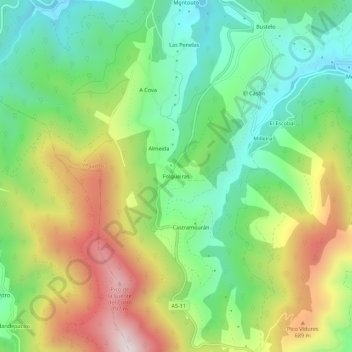
Name: Folgueiras topographic map, elevation, terrain.

Location: Folgueiras, Vegadeo, Asturias, 33776, España (43.39701 -7.04979 43.43701 -7.00979)

Average elevation: 390 m

Minimum elevation: 107 m

Maximum elevation: 836 m

Gear up for your next adventure:

💡Portable Camping Lamp - Rechargeable lamp for campsite lighting
🚲Handlebar Phone Mount - View topographic-map.com live while cycling
🛌Down Sleeping Bag - Superior warmth-to-weight ratio for cold nights
🧴First Aid Kit - Essential first aid supplies for outdoor emergencies
🏕️Camping Hammock - Integrated protection for sleeping between trees

As an Amazon Associate, this site earns from qualifying purchases at no extra cost to you.