
Signayes-Ru topographic map
Interactive map
Click on the map to display elevation.
About this map
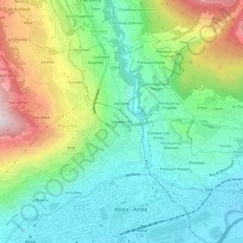
Name: Signayes-Ru topographic map, elevation, terrain.
Location: Signayes-Ru, Arpuilles, Aoste, Vallée d'Aoste, 11100, Italie (45.73152 7.29751 45.77152 7.33751)
Average elevation: 815 m
Minimum elevation: 546 m
Maximum elevation: 1,393 m