Geolocate

Schwindkirchen topographic map

Click on the map to display elevation.

About this map

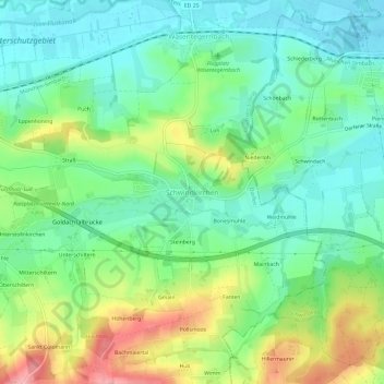
Name: Schwindkirchen topographic map, elevation, terrain.

Location: Schwindkirchen, Dorfen, Landkreis Erding, Bayern, Deutschland (48.23906 12.19372 48.27906 12.23372)

Average elevation: 468 m

Minimum elevation: 427 m

Maximum elevation: 548 m

Gear up for your next adventure:

🧭GPS Handheld Device - Reliable GPS navigation for outdoor adventures
🔭Outdoor Binoculars - Lightweight binoculars for birdwatching and hiking
🧢Sun Protection Cap - Breathable cap to protect from sun exposure
🕯️Camping Lantern - Illuminates your entire campsite with high-efficiency LEDs
🧭GPS Tracker - Track your location in remote areas safely

As an Amazon Associate, this site earns from qualifying purchases at no extra cost to you.