Geolocate

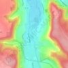
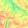
Gouy topographic map

Click on the map to display elevation.

About this map

Name: Gouy topographic map, elevation, terrain.

Location: Gouy, Rouen, Seine-Maritime, Normandy, Metropolitan France, 76520, France (49.34305 1.12256 49.37120 1.16516)

Average elevation: 90 m

Minimum elevation: 2 m

Maximum elevation: 159 m

Other topographic maps

Click on a map to view its topography, its elevation and its terrain.
Saint-Adrien

France > Normandy > Seine-Maritime > Belbeuf

Average elevation: 56 m

Puys Beach

France > Normandy > Seine-Maritime > Dieppe > Puys

Average elevation: 30 m

Le Pollet

France > Normandy > Seine-Maritime > Torcy-le-Petit

Average elevation: 84 m

Edreville

France > Normandy > Seine-Maritime > Octeville-sur-Mer

Average elevation: 78 m

La Grand Route

France > Normandy > Seine-Maritime > Écalles-Alix

Average elevation: 147 m

La Fresnaye

France > Normandy > Seine-Maritime > Buchy

Average elevation: 201 m

Le Pière

France > Normandy > Seine-Maritime > Étaimpuis

Average elevation: 157 m

Gear up for your next adventure:

🧼Travel Hand Sanitizer - Keep hands clean when water is scarce
💡LED Camping Lantern - Illuminate your campsite with long-lasting lanterns
🧥Packable Rain Jacket - Breathable waterproof layer for unpredictable weather
🪜Heavy Duty Carabiners - Multi-use clips for securing gear to your backpack
⛺Bushcraft Tarp - Versatile emergency shelter or gear protection

As an Amazon Associate, this site earns from qualifying purchases at no extra cost to you.