Geolocate

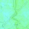
Santo Niño topographic map

Click on the map to display elevation.

About this map

Name: Santo Niño topographic map, elevation, terrain.

Location: Santo Niño, San Simon, Pampanga, Central Luzon, 2015, Philippines (14.97864 120.75307 14.99288 120.77850)

Average elevation: 4 m

Minimum elevation: 1 m

Maximum elevation: 6 m

Other topographic maps

Click on a map to view its topography, its elevation and its terrain.

Santa Monica

Philippines > Pampanga > San Simon

Average elevation: 4 m

San Jose

Philippines > Pampanga > San Simon

Average elevation: 5 m

San Pedro

Philippines > Pampanga > San Simon

Average elevation: 5 m

San Pablo Pulo

Philippines > Pampanga > San Simon

Average elevation: 4 m

Concepcion

Philippines > Pampanga > San Simon

Average elevation: 9 m

Dela Paz

Philippines > Pampanga > San Simon

Average elevation: 4 m

Santo Niño

Philippines > Pampanga > San Simon

Average elevation: 4 m

Gear up for your next adventure:

🔋Lithium AA Batteries - Long-lasting power that performs in extreme cold
📷Outdoor Action Camera - Capture high-elevation views and rugged adventures
🧊Portable Cooler - Keep food and drinks cold during outdoor adventures
🛏️Sleeping Bag - Warm and compact sleeping bags for outdoor camping
💧Hydration Bladder - Hands-free hydration solution for long treks

As an Amazon Associate, this site earns from qualifying purchases at no extra cost to you.