Geolocate

Quillabamba topographic map

Click on the map to display elevation.

About this map

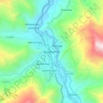
Name: Quillabamba topographic map, elevation, terrain.

Location: Quillabamba, Santa Ana, La Convención, Cusco, 08741, Perú (-12.90635 -72.73244 -12.82635 -72.65244)

Average elevation: 1,470 m

Minimum elevation: 963 m

Maximum elevation: 2,752 m

Other topographic maps

Click on a map to view its topography, its elevation and its terrain.

Río Urubamba

Perú > Cusco > Santa Ana > Sambaray

Average elevation: 1,110 m

Gear up for your next adventure:

🔋Lithium AA Batteries - Long-lasting power that performs in extreme cold
🧴Sunscreen SPF - Broad-spectrum sunscreen for outdoor activities
🥾Hiking Shoes - Durable and comfortable shoes for trail hiking
🎒Fully Waterproof Backpack - Total protection for photography gear and electronics
🧰Survival Kit - Essential gear for emergencies in the wilderness

As an Amazon Associate, this site earns from qualifying purchases at no extra cost to you.