Geolocate

Mont Arthabaska topographic map

Click on the map to display elevation.

About this map
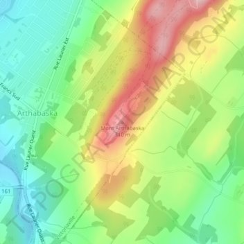
Name: Mont Arthabaska topographic map, elevation, terrain.

Location: Mont Arthabaska, Victoriaville, Arthabaska, Centre-du-Québec, Quebec, G6S 0N4, Canada (46.03735 -71.90169 46.03745 -71.90159)

Average elevation: 205 m

Minimum elevation: 127 m

Maximum elevation: 314 m

Arthabaska trails, hiking, mountain biking, running and outdoor activities

Gear up for your next adventure:

🧼Travel Hand Sanitizer - Keep hands clean when water is scarce
🧣Evaporative Cooling Towel - Beat the heat during intense summer climbs
🕯️Camping Lantern - Illuminates your entire campsite with high-efficiency LEDs
🩹Compact First Aid Kit - Pre-packed essentials for common trail injuries
🧥Ultralight Puffy Jacket - Maximum warmth that packs down to the size of an orange

As an Amazon Associate, this site earns from qualifying purchases at no extra cost to you.