Geolocate

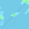
Terogo topographic map

Click on the map to display elevation.

About this map

Name: Terogo topographic map, elevation, terrain.

Location: Terogo, Caramoan, Camarines Sur, Bicol Region, 4429, Philippines (13.76575 123.84028 13.80575 123.88028)

Average elevation: 56 m

Minimum elevation: 0 m

Maximum elevation: 248 m

Other topographic maps

Click on a map to view its topography, its elevation and its terrain.
Lahuy Island

Philippines > Camarines Sur > Caramoan

Average elevation: 7 m

Cotivas Island

Philippines > Camarines Sur > Caramoan

Average elevation: 1 m

Banana Island

Philippines > Camarines Sur > Caramoan > Bikal

Average elevation: 6 m

Gear up for your next adventure:

🔦LED Headtorch - Bright and durable light for night activities
🛰️Satellite Messenger - Emergency communication for areas with no cell service
🔋Emergency Crank Radio - Weather alerts and power without needing batteries
🥾Mountain Trail Shoes - High-traction shoes for mountain trails
🌡️Emergency Mylar Blankets - Compact thermal protection for unexpected nights outdoors

As an Amazon Associate, this site earns from qualifying purchases at no extra cost to you.