Geolocate

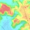
Badem topographic map

Click on the map to display elevation.

About this map

Name: Badem topographic map, elevation, terrain.

Location: Badem, Bardez, North Goa, Goa, 403519, India (15.58521 73.73344 15.62521 73.77344)

Average elevation: 20 m

Minimum elevation: -1 m

Maximum elevation: 96 m

Other topographic maps

Click on a map to view its topography, its elevation and its terrain.

Anjuna

India > Goa > Bardez > Vagator

Average elevation: 12 m

Pilerne Lake

India > Goa > Bardez > Sangolda

Average elevation: 39 m

Corjuem Fort

India > Goa > Bardez > Corjuem

Average elevation: 13 m

Aguada Fort

India > Goa > Bardez > Sinquerim

Average elevation: 8 m

Anjuna

India > Goa > Bardez

Average elevation: 13 m

Anjuna Beach

India > Goa > Bardez > Anjuna

Average elevation: 10 m

Mapusa

India > Goa > Bardez

Mapusa is located at 15°36′N 73°49′E / 15.60°N 73.82°E / 15.60; 73.82. It has an average elevation of 15 metres (49 feet). It lies on the banks of Mapusa River. Mapusa has a tropical climate with temperatures ranging from a high of 37 °C in summer with high levels of humidity to a low of 21 °C in winters.

Average elevation: 29 m

Chapora Fort

India > Goa > Bardez > Chapora

Average elevation: 8 m

Gear up for your next adventure:

👟Leg Gaiters - Keep debris, mud, and snow out of your boots
🎒Hiking Daypack - Lightweight and durable backpacks for day trips and excursions
🧢Hiking Hat - Sun-protective and breathable hats for long treks
🧦Crew Hiking Socks - Comfortable socks for long-distance hikes
⛺Backpacking Tent - Lightweight tent for long-distance hiking trips

As an Amazon Associate, this site earns from qualifying purchases at no extra cost to you.