Geolocate

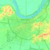
Utica topographic map

Click on the map to display elevation.

About this map

Name: Utica topographic map, elevation, terrain.

Location: Utica, Daviess County, Kentucky, 42376, United States (37.58227 -87.13305 37.62227 -87.09305)

Average elevation: 136 m

Minimum elevation: 119 m

Maximum elevation: 173 m

Other topographic maps

Click on a map to view its topography, its elevation and its terrain.
Owensboro

United States > Kentucky > Daviess County

Average elevation: 123 m

Owensboro

United States > Kentucky > Daviess County

Average elevation: 123 m

Owensboro

United States > Kentucky > Daviess County

Average elevation: 123 m

Owensboro

United States > Kentucky > Daviess County

Average elevation: 123 m

Gear up for your next adventure:

🩹Moleskin Blister Pads - Direct protection for painful foot pressure points
🚑Survival Whistle - Signal for help across long distances in mountains
🧭GPS Handheld Device - Reliable GPS navigation for outdoor adventures
🧰Multitool Knife - Compact and versatile tool for outdoor use
🧣Merino Neck Gaiter - Protects against wind, sun, and cold at high altitudes

As an Amazon Associate, this site earns from qualifying purchases at no extra cost to you.