Geolocate

karima ward topographic map

Click on the map to display elevation.

About this map

Name: karima ward topographic map, elevation, terrain.

Location: karima ward, Othaya, Nyeri, Kenya (-0.57483 36.94034 -0.50873 37.00269)

Average elevation: 1,784 m

Minimum elevation: 1,627 m

Maximum elevation: 1,996 m

Other topographic maps

Click on a map to view its topography, its elevation and its terrain.
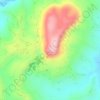
Karĩma Hill

Kenya > Nyeri > Othaya

Average elevation: 1,832 m

Gear up for your next adventure:

🧳Compression Sacks - Maximize space in your backpack by shrinking gear
🥾Mountain Trail Shoes - High-traction shoes for mountain trails
🧢Beanie Hat - Keep your head warm in cold weather
🔭Outdoor Binoculars - Lightweight binoculars for birdwatching and hiking
🧥Waterproof Hiking Jacket - Protect yourself from rain and wind while hiking

As an Amazon Associate, this site earns from qualifying purchases at no extra cost to you.