Geolocate

Navitas topographic map

Click on the map to display elevation.

About this map

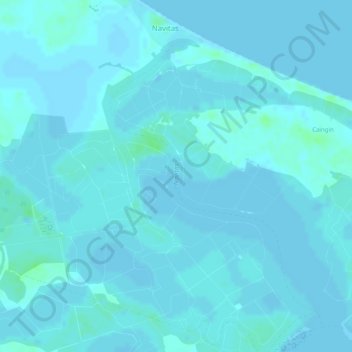
Name: Navitas topographic map, elevation, terrain.

Location: Navitas, Panay, Capiz, Western Visayas, Philippines (11.50682 122.89529 11.52760 122.91146)

Average elevation: 2 m

Minimum elevation: 0 m

Maximum elevation: 8 m

Other topographic maps

Click on a map to view its topography, its elevation and its terrain.

Barangay Pawa

Philippines > Capiz > Panay

Average elevation: 3 m

Tanza Norte

Philippines > Capiz > Panay

Average elevation: 3 m

Pawa

Philippines > Capiz > Panay

Average elevation: 2 m

Pawa

Philippines > Capiz > Panay

Average elevation: 2 m

Gear up for your next adventure:

🥾Durable Hiking Shoes - Long-lasting shoes for frequent hiking
🛌Insulated Sleeping Pad - Critical thermal barrier between you and the cold ground
🧥Packable Rain Jacket - Breathable waterproof layer for unpredictable weather
🚲MTB Frame Bag - Carry tools and maps directly on your bicycle frame
📷Outdoor Action Camera - Capture high-elevation views and rugged adventures

As an Amazon Associate, this site earns from qualifying purchases at no extra cost to you.