
Thank you for supporting this site ❤️
Make a donation
Make a donation
Gear up for your next adventure:
As an Amazon Associate, this site earns from qualifying purchases at no extra cost to you.
Téfam topographic map
Click on the map to display elevation.
Thank you for supporting this site ❤️
Make a donation
Make a donation
Gear up for your next adventure:
As an Amazon Associate, this site earns from qualifying purchases at no extra cost to you.
About this map
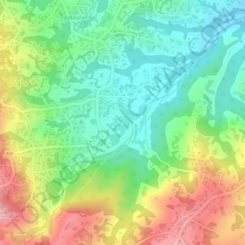
Name: Téfam topographic map, elevation, terrain.
Location: Téfam, Toula, Bayangam, Nkoung-Khi, West, Cameroon (5.25527 10.46239 5.27527 10.48239)
Average elevation: 1,458 m
Minimum elevation: 1,382 m
Maximum elevation: 1,563 m
Thank you for supporting this site ❤️
Make a donation
Make a donation
Gear up for your next adventure:
As an Amazon Associate, this site earns from qualifying purchases at no extra cost to you.