Geolocate

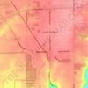
North Madison topographic map

Click on the map to display elevation.

About this map

Name: North Madison topographic map, elevation, terrain.

Location: North Madison, Madison, Jefferson County, Indiana, 47250, United States (38.74784 -85.41663 38.78784 -85.37663)

Average elevation: 258 m

Minimum elevation: 147 m

Maximum elevation: 285 m

Other topographic maps

Click on a map to view its topography, its elevation and its terrain.
Gear up for your next adventure:

🧰Emergency Multi-Tool - Compact multi-tool for outdoor survival
🥾Mountain Hiking Boots - High-traction boots for rocky terrain
🔥Camping Stove - Portable stoves to cook outdoors with ease
💡Portable Camping Lamp - Rechargeable lamp for campsite lighting
💧Filtered Water Bottle - Safe drinking water on the go

As an Amazon Associate, this site earns from qualifying purchases at no extra cost to you.