Geolocate

Karkapatla topographic map

Click on the map to display elevation.

About this map

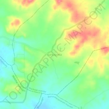
Name: Karkapatla topographic map, elevation, terrain.

Location: Karkapatla, Markook mandal, Siddipet, Telangana, India (17.66222 78.70966 17.70222 78.74966)

Average elevation: 588 m

Minimum elevation: 557 m

Maximum elevation: 630 m

Gear up for your next adventure:

🔦LED Headtorch - Bright and durable light for night activities
🦶Anti-Blister Balm - Prevents friction and hotspots during long ascents
🔥Camping Stove - Portable stoves to cook outdoors with ease
🪑Ultralight Camping Stool - Compact seating for rest stops during long hikes
🛶Kayak Accessories - Essential gear for safe and fun kayaking adventures

As an Amazon Associate, this site earns from qualifying purchases at no extra cost to you.