Geolocate

Guavate topographic map

Click on the map to display elevation.

About this map
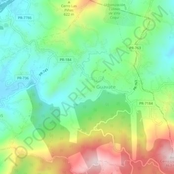
Name: Guavate topographic map, elevation, terrain.

Location: Guavate, Cayey, Puerto Rico, United States (18.11253 -66.09948 18.15259 -66.06030)

Average elevation: 557 m

Minimum elevation: 388 m

Maximum elevation: 859 m

Other topographic maps

Click on a map to view its topography, its elevation and its terrain.

Cayey

United States > Puerto Rico > Cayey

Average elevation: 489 m

Gear up for your next adventure:

🦶Hiking Shoe Insoles - Added support for high arches and long days on feet
🚲Handlebar Phone Mount - View topographic-map.com live while cycling
🥾Trekking Boots - Durable boots for long-distance trekking
🕶️Polarized Sunglasses - Reduces glare from snow and water at high elevations
🧢Beanie Hat - Keep your head warm in cold weather

As an Amazon Associate, this site earns from qualifying purchases at no extra cost to you.