Geolocate

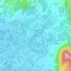
Kampung Simpang topographic map

Click on the map to display elevation.

About this map

Name: Kampung Simpang topographic map, elevation, terrain.

Location: Kampung Simpang, Taiping, Larut, Matang and Selama, Perak, 34700, Malaysia (4.79788 100.68622 4.83788 100.72622)

Average elevation: 10 m

Minimum elevation: 2 m

Maximum elevation: 22 m

Other topographic maps

Click on a map to view its topography, its elevation and its terrain.

Sungai Reba

Malaysia > Perak > Taiping

Average elevation: 4 m

Larut River

Malaysia > Perak > Taiping

Average elevation: 3 m

Sungai Jebong

Malaysia > Perak > Taiping

Average elevation: 46 m

Gear up for your next adventure:

🧰Survival Kit - Essential gear for emergencies in the wilderness
🥾Hiking Shoes - Durable and comfortable shoes for trail hiking
🧼Travel Hand Sanitizer - Keep hands clean when water is scarce
🧤Insulated Winter Gloves - Heavy-duty protection for sub-zero Canadian adventures
💡LED Camping Lantern - Illuminate your campsite with long-lasting lanterns

As an Amazon Associate, this site earns from qualifying purchases at no extra cost to you.