Geolocate

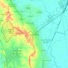
Insein District topographic map

Click on the map to display elevation.

About this map

Name: Insein District topographic map, elevation, terrain.

Location: Insein District, Yangon City, Yangon, Myanmar (16.82272 95.99476 16.94133 96.13611)

Average elevation: 10 m

Minimum elevation: -2 m

Maximum elevation: 49 m

Other topographic maps

Click on a map to view its topography, its elevation and its terrain.

Daing Su

Myanmar > Yangon > Yangon City

Average elevation: 6 m

Daing Su

Myanmar > Yangon > Yangon City

Average elevation: 6 m

Htauk Kyant

Myanmar > Yangon > Yangon City

Average elevation: 17 m

Zee Kone

Myanmar > Yangon > Yangon City

Average elevation: 11 m

Gear up for your next adventure:

🥾Trail Hiking Shoes - Durable shoes designed for rugged trails
🛶Waterproof Dry Bags - Keep electronics and clothes dry during river crossings
👖Convertible Hiking Pants - Zip-off legs to adapt to changing weather conditions
❄️Traction Ice Cleats - Slip-on spikes for icy trails and winter hiking
🥤Collapsible Travel Cup - Saves space and weight in your mess kit

As an Amazon Associate, this site earns from qualifying purchases at no extra cost to you.