Geolocate

Llinars topographic map

Click on the map to display elevation.

About this map

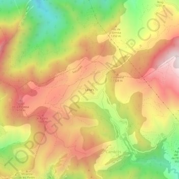
Name: Llinars topographic map, elevation, terrain.

Location: Llinars, Odèn, Solsonés, Lérida, Cataluña, 25794, España (42.12774 1.35921 42.16774 1.39921)

Average elevation: 1,202 m

Minimum elevation: 694 m

Maximum elevation: 1,620 m

Other topographic maps

Click on a map to view its topography, its elevation and its terrain.

25283

España > Cataluña > Solsonés > Odèn

Average elevation: 1,073 m

Gear up for your next adventure:

🦟Insect Repellent - Keep mosquitoes and black flies away in wooded areas
🧣Evaporative Cooling Towel - Beat the heat during intense summer climbs
🥾Trekking Boots - Durable boots for long-distance trekking
💡LED Camping Lantern - Illuminate your campsite with long-lasting lanterns
🛰️Satellite Messenger - Emergency communication for areas with no cell service

As an Amazon Associate, this site earns from qualifying purchases at no extra cost to you.