
Thank you for supporting this site ❤️
Make a donation
Make a donation
Gear up for your next adventure:
As an Amazon Associate, this site earns from qualifying purchases at no extra cost to you.
Eppstein topographic map
Click on the map to display elevation.
Thank you for supporting this site ❤️
Make a donation
Make a donation
Gear up for your next adventure:
As an Amazon Associate, this site earns from qualifying purchases at no extra cost to you.
About this map
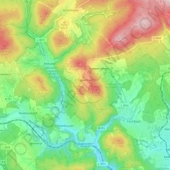
Name: Eppstein topographic map, elevation, terrain.
Location: Eppstein, Main-Taunus-Kreis, Hesse, 65817, Germany (50.12855 8.31765 50.20274 8.41443)
Average elevation: 338 m
Minimum elevation: 173 m
Maximum elevation: 572 m
Thank you for supporting this site ❤️
Make a donation
Make a donation
Gear up for your next adventure:
As an Amazon Associate, this site earns from qualifying purchases at no extra cost to you.