Moscow topographic map
Click on the map to display elevation.
Moscow
Moscow is situated on the banks of the Moskva River, which flows for just over 500 km (311 mi) through the East European Plain in central Russia, not far from the natural border of the forest and forest-steppe zone. 49 bridges span the river and its canals within the city's limits. The elevation of Moscow at the All-Russia Exhibition Center (VVC), where the leading Moscow weather station is situated, is 156 metres (512 feet). Teplostan Upland is the city's highest point at 255 metres (837 feet). The width of Moscow city (not limiting MKAD) from west to east is 39.7 km (24.7 mi), and the length from north to south is 51.8 km (32.2 mi).
About this map
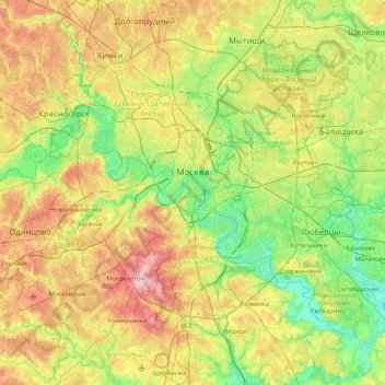
Name: Moscow topographic map, elevation, terrain.
Location: Moscow, Central Federal District, Russia (55.51668 37.29050 55.95777 37.96743)
Average elevation: 162 m
Minimum elevation: 108 m
Maximum elevation: 257 m
Other topographic maps
Click on a map to view its topography, its elevation and its terrain.
Moscow
Moscow is situated on the banks of the Moskva River, which flows for just over 500 km (311 mi) through the East European Plain in central Russia, not far from the natural border of the forest and forest-steppe zone. 49 bridges span the river and its canals within the city's limits. The elevation of Moscow at…
Average elevation: 159 m