
Make a donation
Gear up for your next adventure:
As an Amazon Associate, this site earns from qualifying purchases at no extra cost to you.
Duvenstedt topographic map
Click on the map to display elevation.
Make a donation
Gear up for your next adventure:
As an Amazon Associate, this site earns from qualifying purchases at no extra cost to you.
Duvenstedt
Duvenstedt zählt zu den wohlhabenden Hamburger Stadtteilen. Die durchschnittlichen jährlichen Einkünfte pro Steuerpflichtigem betrugen hier im Jahre 2013 etwa 65.694 Euro und sind deutlich höher als der Hamburger Durchschnitt (39.054 Euro).
Make a donation
Gear up for your next adventure:
As an Amazon Associate, this site earns from qualifying purchases at no extra cost to you.
About this map
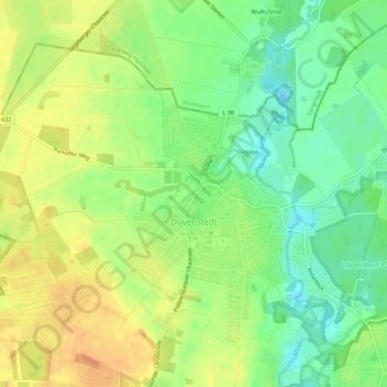
Name: Duvenstedt topographic map, elevation, terrain.
Location: Duvenstedt, Wandsbek, Hamburg, Deutschland (53.69531 10.06924 53.72044 10.12402)
Average elevation: 28 m
Minimum elevation: 9 m
Maximum elevation: 46 m
Make a donation
Gear up for your next adventure:
As an Amazon Associate, this site earns from qualifying purchases at no extra cost to you.