Geolocate

Walag topographic map

Click on the map to display elevation.

About this map

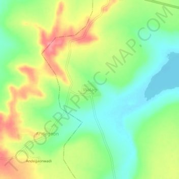
Name: Walag topographic map, elevation, terrain.

Location: Walag, Deglur, Nanded District, Maharashtra, 431718, India (18.44969 77.43821 18.48969 77.47821)

Average elevation: 427 m

Minimum elevation: 389 m

Maximum elevation: 477 m

Other topographic maps

Click on a map to view its topography, its elevation and its terrain.

Lendi

India > Maharashtra > Deglur

Average elevation: 396 m

Gear up for your next adventure:

🥾Durable Hiking Shoes - Long-lasting shoes for frequent hiking
🥾Mountain Hiking Shoes - Shoes with superior grip for mountainous terrain
🥽Outdoor Goggles - Protective eyewear for outdoor activities
🥾Approach Shoes - Shoes designed for climbing approaches and rugged trails
🎒Backpack Rain Cover - External shield to keep your entire pack dry

As an Amazon Associate, this site earns from qualifying purchases at no extra cost to you.