
Thank you for supporting this site ❤️
Make a donation
Make a donation
Gear up for your next adventure:
As an Amazon Associate, this site earns from qualifying purchases at no extra cost to you.
Navalmoral topographic map
Click on the map to display elevation.
Thank you for supporting this site ❤️
Make a donation
Make a donation
Gear up for your next adventure:
As an Amazon Associate, this site earns from qualifying purchases at no extra cost to you.
About this map
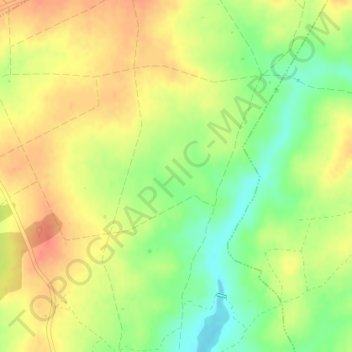
Name: Navalmoral topographic map, elevation, terrain.
Location: Navalmoral, Salce, Zamora, Castilië en León, Spanje (41.28312 -6.22214 41.30312 -6.20214)
Average elevation: 756 m
Minimum elevation: 728 m
Maximum elevation: 777 m
Thank you for supporting this site ❤️
Make a donation
Make a donation
Gear up for your next adventure:
As an Amazon Associate, this site earns from qualifying purchases at no extra cost to you.