Geolocate

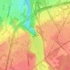
Saint-Rédempteur topographic map

Click on the map to display elevation.

About this map

Name: Saint-Rédempteur topographic map, elevation, terrain.

Location: Saint-Rédempteur, Les Chutes-de-la-Chaudière-Ouest, Lévis, Chaudière-Appalaches, Québec, Canada (46.68121 -71.30792 46.70848 -71.27623)

Average elevation: 76 m

Minimum elevation: 52 m

Maximum elevation: 89 m

Other topographic maps

Click on a map to view its topography, its elevation and its terrain.

Fleuve Saint-Laurent

Canada > Québec > Lévis

Average elevation: 137 m

Chutes de la Chaudière

Canada > Québec > Lévis

Average elevation: 57 m

Parc du Rapide

Canada > Québec > Lévis

Average elevation: 52 m

Parc de la Vanoise

Canada > Québec > Lévis

Average elevation: 42 m

Parc de la Vanoise

Canada > Québec > Lévis

Average elevation: 42 m

Gear up for your next adventure:

🏃Hydration Running Vest - Carry water and maps close to your body for speed
💧Hydration Pack - Hands-free hydration system for long hikes
🎒Fully Waterproof Backpack - Total protection for photography gear and electronics
💡Portable Camping Lamp - Rechargeable lamp for campsite lighting
🥾Light Trekking Boots - Supportive boots for multi-day treks

As an Amazon Associate, this site earns from qualifying purchases at no extra cost to you.