Geolocate

Panacea topographic map

Click on the map to display elevation.

About this map

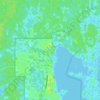
Name: Panacea topographic map, elevation, terrain.

Location: Panacea, Wakulla County, Florida, United States (30.01743 -84.40768 30.05743 -84.36768)

Average elevation: 6 m

Minimum elevation: -2 m

Maximum elevation: 16 m

Other topographic maps

Click on a map to view its topography, its elevation and its terrain.

Saint Marks

United States > Florida > Wakulla County

Average elevation: 4 m

Sopchoppy

United States > Florida > Wakulla County

Average elevation: 9 m

Gear up for your next adventure:

🥾Waterproof Trail Shoes - Shoes designed to handle wet terrain
🧰Emergency Multi-Tool - Compact multi-tool for outdoor survival
🧰Multitool Knife - Compact and versatile tool for outdoor use
💧Filtered Water Bottle - Safe drinking water on the go
Camping Coffee Maker - Brew fresh coffee anywhere on the topographic map

As an Amazon Associate, this site earns from qualifying purchases at no extra cost to you.