
Thank you for supporting this site ❤️
Make a donation
Make a donation
Gear up for your next adventure:
As an Amazon Associate, this site earns from qualifying purchases at no extra cost to you.
Quilanga topographic map
Click on the map to display elevation.
Thank you for supporting this site ❤️
Make a donation
Make a donation
Gear up for your next adventure:
As an Amazon Associate, this site earns from qualifying purchases at no extra cost to you.
About this map
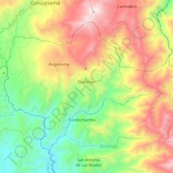
Name: Quilanga topographic map, elevation, terrain.
Location: Quilanga, Cantón Quilanga, Ecuador (-4.35628 -79.47168 -4.24684 -79.32422)
Average elevation: 1,964 m
Minimum elevation: 1,177 m
Maximum elevation: 3,082 m
Thank you for supporting this site ❤️
Make a donation
Make a donation
Gear up for your next adventure:
As an Amazon Associate, this site earns from qualifying purchases at no extra cost to you.