Geolocate

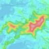
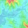
Mount White topographic map

Click on the map to display elevation.

About this map

Name: Mount White topographic map, elevation, terrain.

Location: Mount White, Gosford, New South Wales, Australia (-33.47588 151.15837 -33.42807 151.22110)

Average elevation: 123 m

Minimum elevation: -1 m

Maximum elevation: 269 m

Other topographic maps

Click on a map to view its topography, its elevation and its terrain.
Mount White

Australia > New South Wales > Gosford

Average elevation: 139 m

Wyong River

Australia > New South Wales > Gosford

Average elevation: 175 m

Wamberal Beach

Australia > New South Wales > Gosford

Average elevation: 7 m

Mount Elliot

Australia > New South Wales > Gosford

Average elevation: 92 m

Erina Creek

Australia > New South Wales > Gosford

Average elevation: 23 m

Gear up for your next adventure:

🧥Waterproof Hiking Jacket - Protect yourself from rain and wind while hiking
⛺Bushcraft Tarp - Versatile emergency shelter or gear protection
🎒Fully Waterproof Backpack - Total protection for photography gear and electronics
🧴First Aid Kit - Essential first aid supplies for outdoor emergencies
🥾Lightweight Hiking Shoes - Comfortable shoes for day hikes

As an Amazon Associate, this site earns from qualifying purchases at no extra cost to you.