Geolocate

L'Infiestu topographic map

Click on the map to display elevation.

About this map

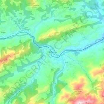
Name: L'Infiestu topographic map, elevation, terrain.

Location: L'Infiestu, Piloña, Asturias, 33530, Spain (43.30791 -5.40395 43.38791 -5.32395)

Average elevation: 312 m

Minimum elevation: 102 m

Maximum elevation: 922 m

Other topographic maps

Click on a map to view its topography, its elevation and its terrain.

San Román

Spain > Asturias > Piloña

Average elevation: 233 m

Gear up for your next adventure:

🧰Emergency Multi-Tool - Compact multi-tool for outdoor survival
🥾Trekking Poles - Adjustable trekking poles to reduce knee stress and improve stability
Bushcraft Tarp - Versatile emergency shelter or gear protection
🛶Kayak Dry Bag - Waterproof storage for kayaking adventures
🦶Hiking Shoe Insoles - Added support for high arches and long days on feet

As an Amazon Associate, this site earns from qualifying purchases at no extra cost to you.