Geolocate

Doset topographic map

Click on the map to display elevation.

About this map

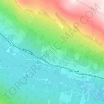
Name: Doset topographic map, elevation, terrain.

Location: Doset, Lesjaverk, Lesja, Innlandet, 2667, Norway (62.17958 8.50195 62.21958 8.54195)

Average elevation: 768 m

Minimum elevation: 593 m

Maximum elevation: 1,224 m

Gear up for your next adventure:

🍽️Titanium Camping Spork - Ultralight and indestructible eating utensil
🏕️Camping Hammock - Integrated protection for sleeping between trees
🗺️Topographic Maps - Detailed maps to explore trails, mountains, and wilderness areas
🦶Hiking Shoe Insoles - Added support for high arches and long days on feet
🥾Approach Boots - Comfortable boots for hiking and climbing approaches

As an Amazon Associate, this site earns from qualifying purchases at no extra cost to you.