
Thank you for supporting this site ❤️
Make a donation
Make a donation
Gear up for your next adventure:
As an Amazon Associate, this site earns from qualifying purchases at no extra cost to you.
Peñalba topographic map
Click on the map to display elevation.
Thank you for supporting this site ❤️
Make a donation
Make a donation
Gear up for your next adventure:
As an Amazon Associate, this site earns from qualifying purchases at no extra cost to you.
About this map
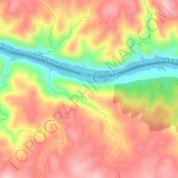
Name: Peñalba topographic map, elevation, terrain.
Location: Peñalba, Santiago de Alcântara, Cáceres, Estremadura, Espanha (39.64816 -7.22759 39.66816 -7.20759)
Average elevation: 216 m
Minimum elevation: 112 m
Maximum elevation: 286 m
Thank you for supporting this site ❤️
Make a donation
Make a donation
Gear up for your next adventure:
As an Amazon Associate, this site earns from qualifying purchases at no extra cost to you.