Geolocate

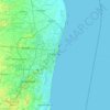
Tondiarpet topographic map

Click on the map to display elevation.

About this map

Name: Tondiarpet topographic map, elevation, terrain.

Location: Tondiarpet, Chennai, Chennai District, Tamil Nadu, 600001, India (13.10454 80.23904 13.14801 80.30021)

Average elevation: 4 m

Minimum elevation: -1 m

Maximum elevation: 13 m

Other topographic maps

Click on a map to view its topography, its elevation and its terrain.

Madipakkam Lake

India > Tamil Nadu > Chennai

Average elevation: 10 m

MPT Ground

India > Tamil Nadu > Chennai

Average elevation: 6 m

GKM Colony

India > Tamil Nadu > Chennai

Average elevation: 12 m

Kondithope

India > Tamil Nadu > Chennai

Average elevation: 9 m

Narayanapuram Lake

India > Tamil Nadu > Chennai

Average elevation: 5 m

The Island

India > Tamil Nadu > Chennai

Average elevation: 11 m

Maduvankarai

India > Tamil Nadu > Chennai

Average elevation: 13 m

Anna Nagar Tower

India > Tamil Nadu > Chennai

Average elevation: 14 m

Gear up for your next adventure:

🧭GPS Outdoor Watch - Smart watch for navigation and fitness tracking in nature
🥾Waterproof Hiking Shoes - Durable shoes for wet and rugged trails
🥾Hiking Shoes - Durable and comfortable shoes for trail hiking
🌬️Windproof Camp Stove - Efficient cooking even on exposed mountain peaks
🥾Mountain Hiking Shoes - Shoes with superior grip for mountainous terrain

As an Amazon Associate, this site earns from qualifying purchases at no extra cost to you.