Geolocate

Salingogon topographic map

Click on the map to display elevation.

About this map
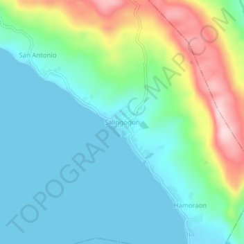
Name: Salingogon topographic map, elevation, terrain.

Location: Salingogon, Minalabac, Camarines Sur, Bicol Region, 4414, Philippines (13.41461 123.17048 13.45461 123.21048)

Average elevation: 77 m

Minimum elevation: 0 m

Maximum elevation: 290 m

Other topographic maps

Click on a map to view its topography, its elevation and its terrain.

Manapao

Philippines > Camarines Sur > Minalabac

Average elevation: 14 m

Gear up for your next adventure:

🥾All-Terrain Hiking Boots - Versatile boots for varied hiking conditions
🧰Multitool Knife - Compact and versatile tool for outdoor use
🛶Canoe Life Vest - Safety vest for water sports
🚲Heavy Duty Bike Lock - Secure your bike at the trailhead or during stops
🎒Hiking Backpack - Lightweight and ergonomic backpacks for day hikes or multi-day treks

As an Amazon Associate, this site earns from qualifying purchases at no extra cost to you.